Written by Ben Johnson
The Geotechnics Module Add-on for Civil 3D, which is available for download to subscription members, is a really great tool for modeling and hatching borehole data dynamically.
Your borehole data can be imported from an excel .csv file, or from AGS 3.1 & 4 formats. Your data needs to be set up with the proper columns in order to be imported properly. This can all be found in the module help file.
Once your data is imported, it will be represented by a 3D solid for each borehole which has a vertical exaggeration setting you can adjust as needed.

3D Solids Created When Importing .CSV Data
From there you can create surfaces of each stratum using the Strata Manager. This is a great tool for calculating volumes.

Create Surfaces for Each Stratum
There is also a Hatch Manager which controls how each stratum is represented, and you can also cut profiles of the data.
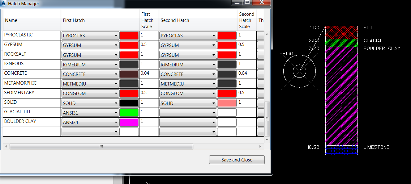
Hatch Manager Controls how Strata are Represented
This tool really is a time saver, and it is dynamic so if you add data to your .csv file, for instance, you can simply reimport the .csv data, and everything will update accordingly in Civil 3D. There is a useful tip to share when using this tool though.
There is an important step to take if you are trying to save a new drawing and overwrite an existing one with the same name. You will first need to delete the .sdf file (spatial data file) associated with that original file. This is found in the same folder as the drawing file. If you do not delete this file first, then the Geotechnics Module will allow you to import the data, but none of the other functions will work. You will get a message telling you to import data before the functions are available. You may think the module simply is not working right, but the real reason is that the .sdf file is associated to data that no longer exists.
Where is the vertical exaggeration setting for 3D view?
The vertical exaggeration is adjusted within the Strata Manager. Open the Strata Manager, and you will see the vertical exaggeration value at the top of the dialog box. Enter a new value, and click the Update button to regenerate the 3D solids.
I wonder if you’ve found a way to increase the font/text/label size of text associated with boring strips projected to a profile? 0.2 isn’t cutting it with a 160-ft hole!