In last months tip we discussed Importing Terrain from Graphics. However when using the Edit Terrain Model toolbar it reports “Not an Editable Terrain”.
What if we wanted to edit the graphics in the design file to update the Terrain Model instead of using the Edit Terrain Model toolbar. The following steps will show you how to do that.
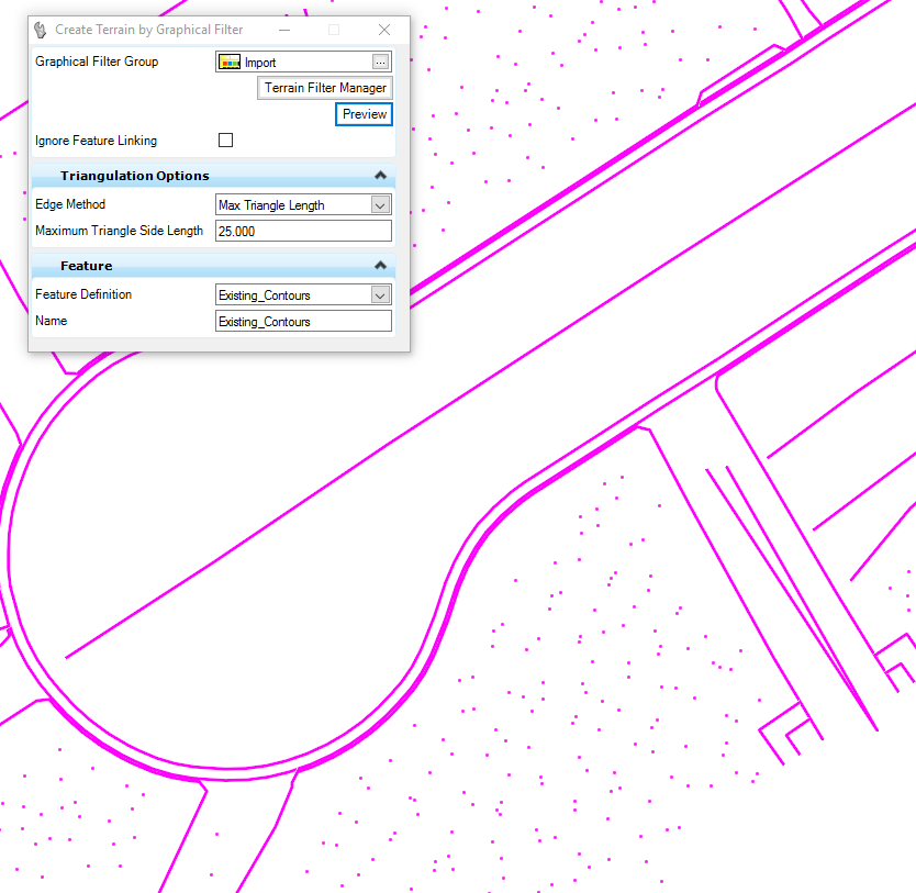
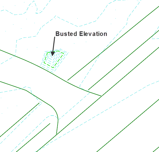
This example shows an incorrect elevation of a point created using the ‘Terrain Model By Graphical Filter’ command.
1. First use MicroStation tools to edit the graphics in the design file (element info. is one option).
2. Once the point has been edited, in Project Explorer go to the Civil Model tab and expand the Terrain Models listed.
3. Expand the Terrain Model you need to update.
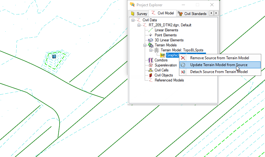
4. Right click on the Graphical Filter Group and from the pop up menu select Update Terrain Model from Source.

Note: The graphics will be updated and your Terrain display will refresh.
Contact us if you need help developing new workflows, resources, or need training for OpenRoads.