As you start working on a new terrain it is useful to get a feel for the drainage patterns. OpenRoads has a number of tools to assist with this; one of them is the Analyze Trace Slope command. This command works best in the 3D model.
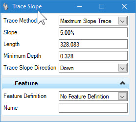
There are two methods for this command:
- Maximum Trace Slope – Traces the slope in most direct (steepest) direction. This method is most suitable for our analysis.
- Constant slope trace – Traces a user-defined slope value. This is useful, for instance, where you need to determine a path for a roadway (or another design element) which has a maximum slope design constraint. The slope entry in the dialog is used only for this method.
- Length – The length (in master units) that the command will trace the slope.
- Minimum Depth – Terrain models often contain minor depressions which are insignificant in the context of drainage design. If this is set to zero, then even the tiniest of depressions will stop the trace from proceeding. Usual values are in the range of 0.1ft to 1.0ft.
- Direction – The trace command can go in either direction.

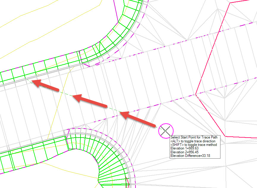
After the command starts, you will Select the terrain model, then move the cursor over the surface. NOTE: This image is enhanced for the webpage.

If you click on the view then the trace elements are drawn into the file as graphic elements.
