Written by Bob Mecham.
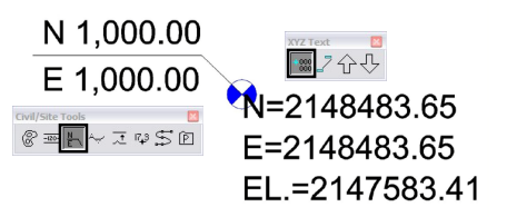
The two MicroStation tools I use the most for labeling coordinates are XYZ Text and Civil/Site Tools. Both set of toolboxes have icons for labeling coordinates. You start scratching your head when each tool gives you a different coordinate number. The screen shot below shows an example of what I mean.

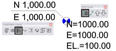
What has happened here is an Auxiliary Coordinate System (ACS) that has been defined. The Label Coordinate tool from XYZ Text toolbox is labeling based on the current ACS. If you want to label the point based on the real world coordinates type this into the key-in browser ‘label useacs toggle‘.

Now both tools are labeling the same point with the same coordinates. If you have never seen this before you are lucky, but print this out and keep it on hand.
Last Month’s MicroStation Tip – Controlling the Origin of a Copy/Paste
Don’t want to miss out on other great information? Subscribe to this blog or our monthly eNewsletter now!
Learn More ◊ Contact us today ◊ Newsletter ◊
