Written by: Bob Mecham
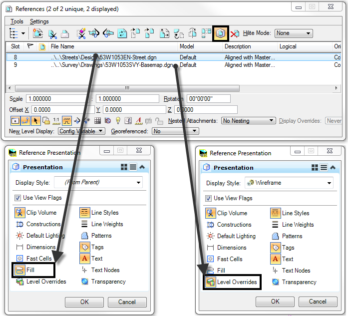
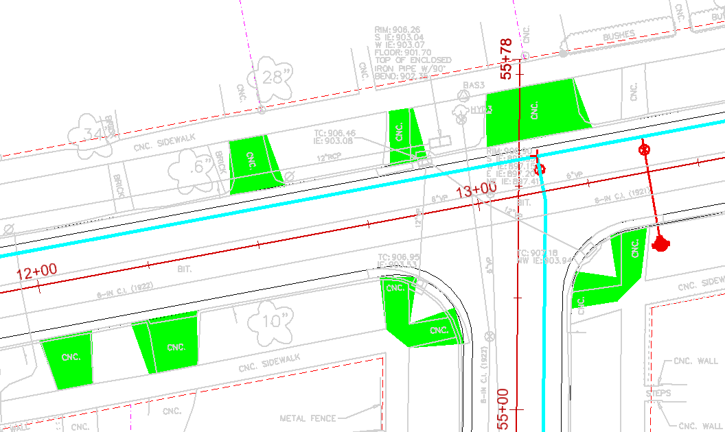
You are probably aware of using View Attributes in MicroStation. The View Attributes dialog allows you to affect whether and how certain type of elements display in the entire drawing. Have you ever came across the situation where you wanted to change View Attributes for a specific Reference file? For example, say you wanted to have Level Overrides ON only for your basemap and you wanted Fill ON only for your design drawing. Setting the View Flags option ON in the Set Reference Presentation dialog does just that.
1. From the References dialog box select the Reference File in the dialog you want to work with.
2. From the Reference dialog box pull down menu Settings > Presentation. The Reference Presentation dialog will appear.
3. Check ON Use View Flags. This will work as an override of the current drawing view attributes.
4. Toggle ON or OFF the View Attributes you want for the reference file.
5. Click the OK button. The dialog will close.
Last Month’s Tips:

Civil 3D: Converting Civil       InRoads Tip:  Place Dimensions in        VBA Tip:  Maximize the
3D Alignments to ArcGIS Shapefiles       in Roadway Designer           MicroStation ElementEnumerator
Don’t want to miss out on other great information? Subscribe to this blog or our monthly eNewsletter now! Learn More ◊ Contact us today ◊ Newsletter ◊
