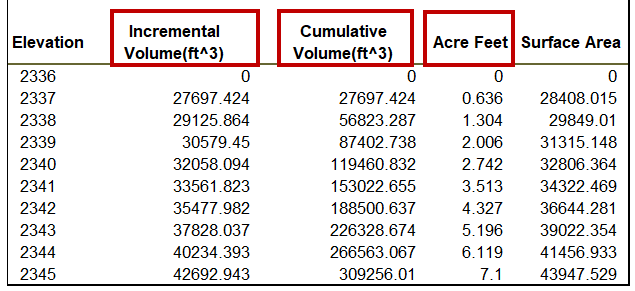
OpenRoads Designer includes a Compute Pond Volumes application tool. This report can be helpful for Drainage Analysis and Reporting for Stormwater Water Management facilities on projects.

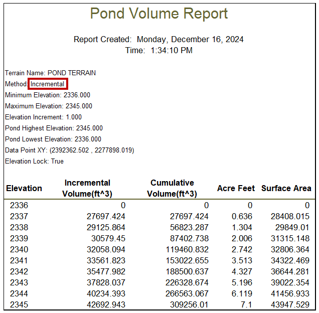
The Compute Pond Volumes application tool has two methods for calculating the volume of a pond terrain: Single (as shown above) and Incremental (as shown below).
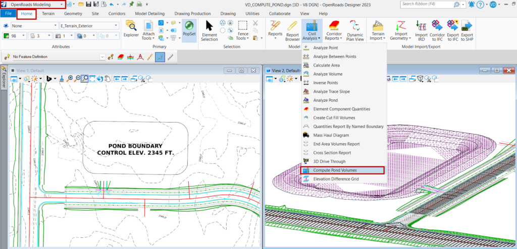
- In OpenRoads Designer, select OpenRoads Modeling > Home > Model Analysis and Reporting > Compute Pond Volumes.
- The Application dialog will appear.
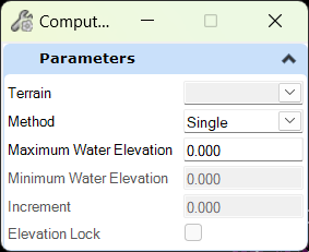
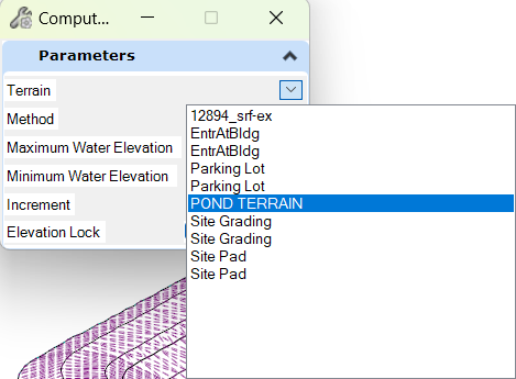
- Select the Pond Terrain from the list on the dialog or click on the terrain in the default 3D model view.
Note: This terrain can be modeled separately with the OpenRoads Designer > Model Detailing application tools. It can also be combined with other corridors and existing terrain surface to build a finished terrain surface with the OpenRoads Designer > Create Complex Terrain application tools.
Single Method
1. Select the drop-down for Method and select Single.
2. Type the Maximum Water Elevation to query into the key-in field.
Note: This is an elevation between the top and bottom elevations of the pond.
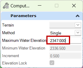
3. Left-click within the default 3D model to accept all the dialog parameters, and then left-click once more inside the pond.
4. The Bentley Civil Report Browser will appear, and the Pond volume and area are reported as calculated.

Incremental Method
1. Select the drop-down for Method and select Incremental.
2. Input the Maximum Water Elevation to be queried.
3. Input the Minimum Water Elevation to be queried.
4. Input the Increment (in feet) to query.
5. Use Elevation Lock to set the results to whole numbers.
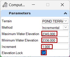
6. Left-click in the default 3D model to accept all the dialog parameters and left-click once more inside the pond.
7. The Bentley Civil Report Browser will appear, and the incremental and cumulative Pond volumes and areas are reported as calculated.
