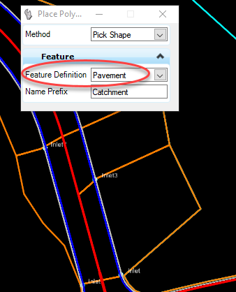
When a catchment is created in SUDA, a feature definition is assigned to the catchment.

This feature definition will assign symbology to the catchment feature, (red in this example) and also assigns the run-off coefficient to the catchment.

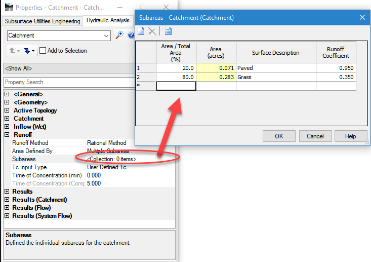
However, in most cases the runoff coefficient needs to be weighted based on the relative percentages of different types of land use within the catchment. To accomplish this, in properties change the Area Defined By property from Single Area to Multiple Subareas.
For each subarea, entire the percentage of the total area and the desired runoff coefficient corresponding to that land use type. A weighted average is computed from these numbers and used for the runoff calculations. Note: There are no tools for automatically determining the percentages based on global land use shapes, as some GEOPAK Drainage designers were accustomed.

