OpenRoads Tip: Terrain Model – Control Triangles in Concave Areas of Project

Pretty much every project has one or more areas like shown below, where terrain model triangles will cut across the concave corner of the project.
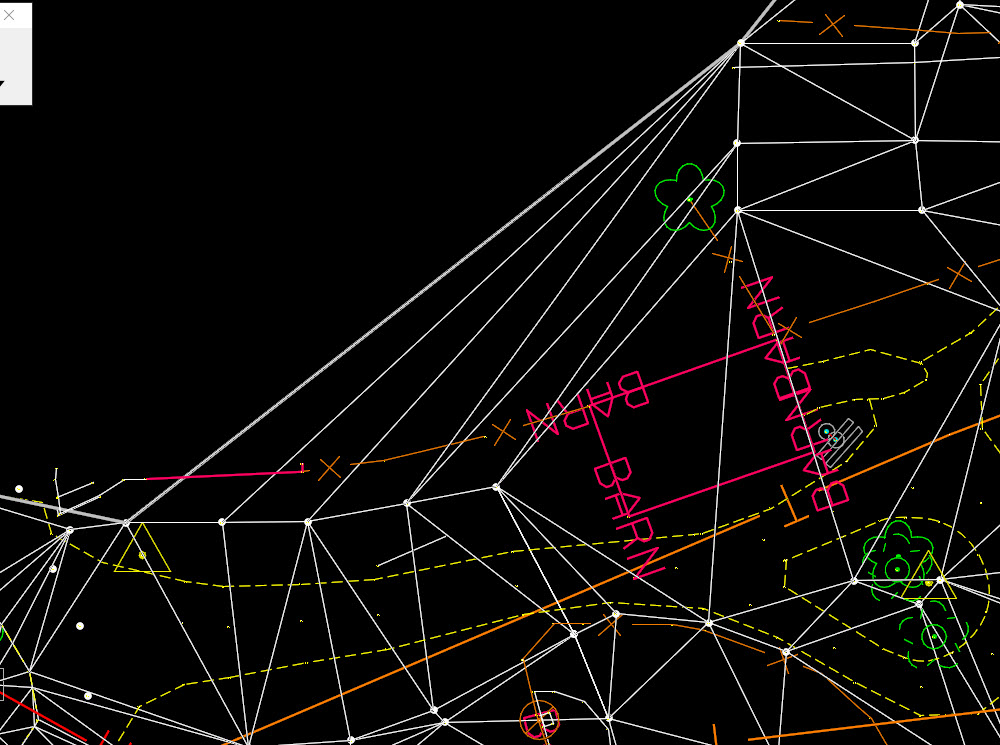
openroads terrain element model triangles concave area boundary

My first choice is always to adjust the Edge Method to “Max Triangle Length”, but even with the most appropriate choice, there will still usually be areas where triangles cut the corner.
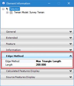
openroads terrain element model triangles edge method

At the point, many people will start using the Terrain Edit tools to delete the stray triangles. The problem with this approach is that I must remove the rules from the terrain mode, such as survey point rules or graphic element rules.  Now I have a terrain model with clean corners but is “dumb” and will not update.

The best way to control the triangles is by adding boundary elements (yes plural) to the terrain model.

There is a tool that will add a boundary to the entire terrain.  This boundary can be edited to control these concave corners.  The “problem” is that this creates a line string completely around the terrain which can interfere with picking the terrain by downstream designers. The line string gets picked first which then requires that the consumer of the terrain do mouse reset gymnastics to pick the terrain.

To avoid this complication, I add multiple boundary elements wherever I need to control triangles but only for the minimum distance around the terrain model. In the image below, I have drawn a smart line (red dashed) by snapping to the survey points around the portion of the boundary where I need to remove triangles.

openroads terrain element model triangles concave area boundary

Then use the Add Features command to add the line string as a boundary element.
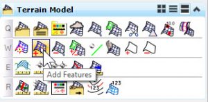
openroads terrain element model add features openroads terrain element model feature type boundary

Now, my corners are clean in the specific areas I care about and I have not created an undue burden on downstream consumers of the terrain.

openroads terrain element model triangles concave area boundary


See more OpenRoads Tips or dive deeper with Instructor-Led or Self-Paced Training.

Robert Garrett

Robert has over 25 years experience as a practicing engineer and is licensed in the State of Tennessee. After graduating from Tennessee Technological University, Robert worked for the Mississippi State Highway Department, Bridge Design Division. Then he spent 12 years with the Tennessee Department of Transportation in the Roadway Design Office and later served as Regional Manager in the Design Survey Office. From 2000 to 2006, Robert worked for Robert G Campbell and Associates in Knoxville, TN where responsibilities included roadway, site, and utilities design projects. Joining Bentley Systems in March 2006, Robert wrote specifications & documentation for software development. Duties included testing, customer feedback and ensuring the products met the needs of the civil engineering user base. He also developed training material for education both internally to Bentley and for outside organizations. He served as Product Manager for Utilities Products, including the new OpenRoads Subsurface Utilities Design and Analysis software. Robert also provided guidance and implementation services for new technologies. He is a frequent presenter and trainer at user conferences.

Tags: ,

Leave a Reply

Your email address will not be published. Required fields are marked *